What's New
- Work Manager App updates and improvements both interface and functionality
- GIS functionality updates
New Features and Enhancements
Work Manager App
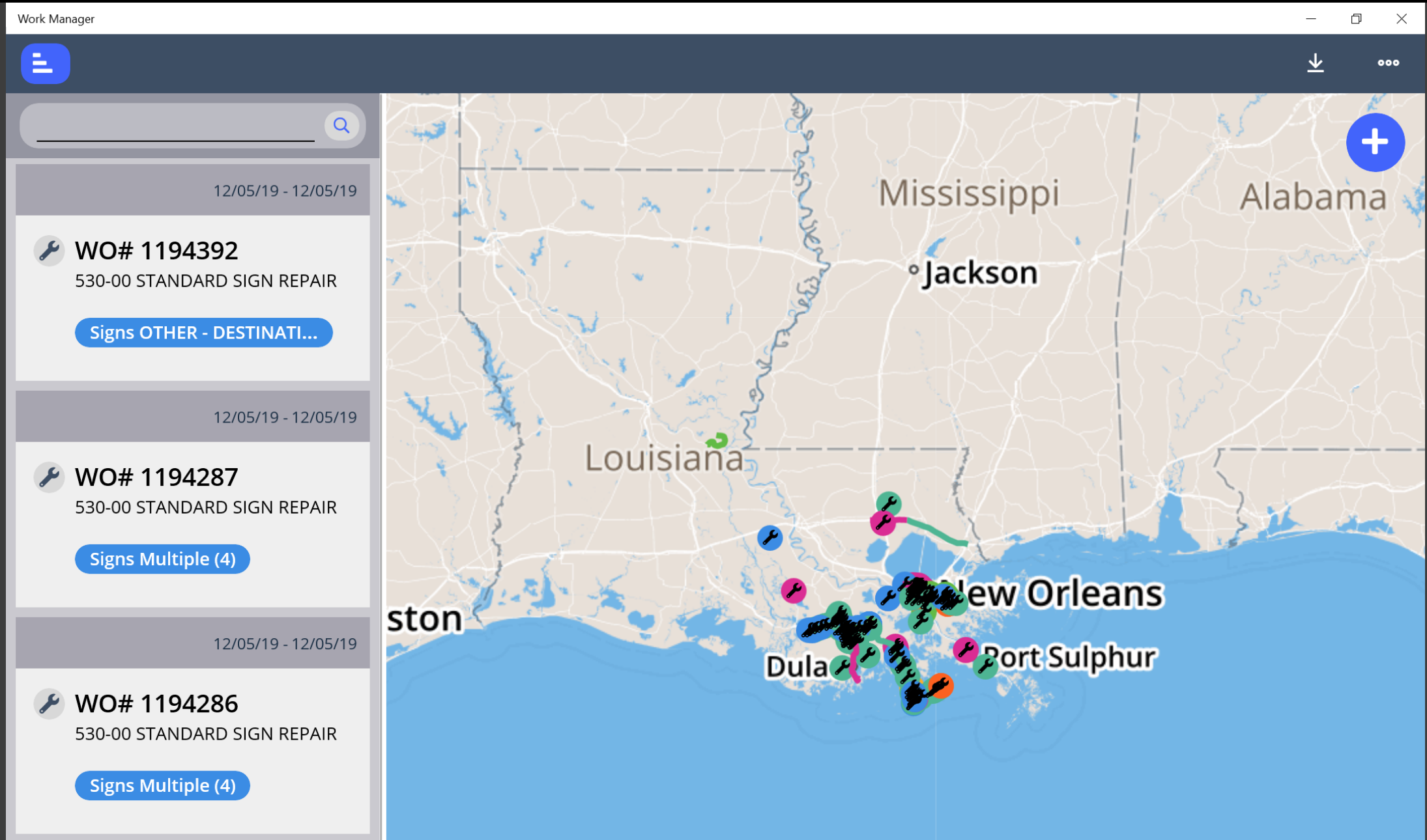
- Work Manager has new and improved map functionality. The maps can now be configured to automatically download upon zooming into a locationd as long as the device has internet connectivity.
- Work Manager now supports Android 9 in addition to iOS and Windows and previous Android versions.
- The left panel that displays Work Orders will now be restricted to 380 pixels wide or 50% of the screen width, whichever is less, so that users can turn the screen to landscape to see a larger portion of the map.
GIS Explorer
- It is now possible to restrict users to only view and access assets for the admin units of which they are a part. This is applicable on the map as well as data panes.
- The Use the Current Coordinate System radio button is now enabled in the Export Layer in GIS window.
- It is now possible to save a map with layers inside a group.
- Group visibility now supersedes layer visibility settings. When a layer set to display is added to a group not set to display, the layer will not appear on the map.
Other Improvements and Bug Fixes
- Added: Cut and Paste are now available in the Roadway shortcuts menu.
- Fixed: Issue in all products using right-to-left interface has been resolved and grid record indicator is now reversed.
- Fixed: Issue in Structures Inspector mobile app has been resolved and attached images no longer appear as thumbnails in devices running iOS 13.
- Fixed: Issue in Structures Inspector mobile app has been resolved and the map in the home screen now displays a continuous map in devices running Android 10.
- Fixed: Issue in Fleet Management has been resolved and the flag that indicates whether equipment is still under warranty now functions correctly.
- Fixed: Issue in Maintenance Manager has been resolved and Start and End dates and Duration are now set properly when issuing a Work Order from a Work Request.
- Fixed: Issue in Pavement Analyst has been resolved and the optimization process now calculates treatment and cost for the years preceding projects in the Master Work Plan.
- Fixed: Issue in Pavement Analyst has been resolved and the Time-Delayed Import Tool (TDIT) no longer creates duplicate records that cause the tool to malfunction.
- Fixed: Issue in Pavement Analyst has been resolved and Condition Down the Road graphs no longer generate an error on data and graph.
- Fixed: Issue in Resources has been resolved and users can now approve hours, have those approved hours appear in the Timesheet pop-up, and have Total Hours display correctly in Employees table.
- Fixed: Issue in Roadway has been resolved and after rescinding approval for labor or equipment day cards to edit them, a save is now required before the user is able to approve the day card again.
- Fixed: Issue in Roadway has been resolved and the Work Order number is now listed correctly in the Day Cards window.
- Fixed: Issue in Roadway has been resolved and users cannot approve day cards that are dated in the future.
- Fixed: Issue in Roadway has been resolved and Work Order History window now includes Work Location.
- Fixed: Issue in Structures Inspector has been resolved and the Bridge Daily Extract report now only includes active bridges.
- Fixed: Issue in System has been resolved and geometry and other attributes that are part of a data set are now included in the import process.
- Fixed: Issue in System has been resolved and Report Owner is now set to correctly identify who the report was copied to when a report is copied from an existing report.
- Fixed: Issue in System has been resolved and system audit dates for application systems based on a Postgres database are now calculated and stored by the second.
- Fixed: Issue in Work Manager has been resolved and Create Asset View now works correctly.
Known Issues, Limitations, and Restrictions
Updates
- For windows devices, text boxes in the Structures Inspector mobile app, such as the General Notes field in the general inspection form or the Comments field in access needs form, display the input cursor in the middle of the text box, instead of at the top of the text box.
The Structures Inspector mobile app may crash when more than 10 photos are selected from the device album to be attached to an inspection record
Work Manager App users on Android devices with memory of less than 2GB may receive an Out of Memory Exception. Please close and reopen the app daily to avoid this issue.
Work Manager App occasionally crashes on Android devices when navigating quickly between several pages.
When a user adds multiple photos to an inspections from a device with a full camera roll on an Android device the Structures Inspector mobile app may crash.
The Work Manager mobile app may crash when navigating quickly between pages on Android devices.
The Work Manager mobile app keyboard overlaps some fields when expanded on Android devices.
The Structures Inspector mobile app lists inspections in QC and QA for download but if those inspections are edited, the sync process will halt and users must click Delete on device and continue to sync their other inspections.
When downloading for the first time, please check the status of inspections and do not download inspections with a QC or QA status. To review the status of inspections that have already been downloaded, click
 and select Download Inspections.
The Structures Inspector mobile app Condition State comment text box covers the tittle.
The Structures Inspector mobile app lists the date updated as the date it was last modified from the web application even if it has been modified more recently in the mobile app.
The supplied CORS filter for Tomcat will not work on Tomcat version 8.5.32 and above. Customers need to review the use of the CORS filter and update web.xml as needed. Additional information can be found at https://tomcat.apache.org/tomcat-8.5-doc/config/filter.html
The discovery date is absent on the flag screen in Structures Inspector. Currently, the default date is the current date for flags created in the web app.
The Structures Inspector mobile app screen shifts when closing a pop-up window.
Flags can now be created in the Structures Inspector mobile app but must still be submitted to QC using the web application. Additionally, Flags Superseding and Discovery Date are not yet available in the app.
When syncing the Structures Inspector App on a Windows OS, the map closes up and has to be refocused using the zoom controls.
Flags cannot be set to supersede each other in the Structures Inspector mobile app.
When multiple users of the Work Manager app use the same device, they will be able to see all unsynced changes on that device from their sync screen.
On Windows 10 devices the Structures Inspector app freezes when saving an edited photo to attach to a condition rating.
As of Chrome 71, browser pop-ups may be blocked which will negatively affect system operations. To address this in Chrome go to Settings > Advanced > Content Settings > Pop ups and redirects and then add the URL for the application.
The new GIS Explorer like all web mapping applications requires datasets in the geographic coordinate system (EPSG:4326), so customer schemas with data stored in a different coordinate system would need to be transformed in order for map layers to be created from the dataset. See the section on re-projecting geometries in the Implementation Guide
Inserting a location or inventory item from a map is not functional when using Firefox as your web browser. To work around this limitation, use the other supported web browsers: IE 11, Chrome or Safari
When you select to print a map as an image (png file) using Firefox as your web browser, the file is downloaded as map.png.pdf. You would have to manually edit out the '.pdf' extension from the file name, after the file has been downloaded, to be able to open/use the file
When you define a map print template of size 34x44 or larger, an error is returned since the size of the generated map image always times before a PDF for printing is generated
While working on the GIS Interface and performing tasks that does not generate a request to the server (such as styling a map), your user session may expire as a result. The configured session expiration warnings will be displayed when this occurs or your session may timeout and a session expiration notification displayed, if a warning is not configured
Map filter value does not get pre-populated in the Jasper report print template, even though the parameter is specified for display in the template
Map filter value cannot be defined or edited for a map with a specified area of interest. To work around the definition limitation, the map filter should be defined before the AOI is set
A map's layer style settings become null and un-editable, when an applied filter is partially applicable or not applicable to the defined styling attribute values for the map
On a map bound to a data window, some items when selected on the map aren't highlighted in the data window because they aren't present there (In a data window, items can be Access Regulated), but on the map all inventory items are displayed
The loading and display of maps and associated styles in IE 11 is not as performant as Chrome, Firefox and Safari
In the Roads & Highways interface, routes with curves are not handled properly by the ESRI FDGB API. A workaround is to have the agency densify the routes to turn the curves into line strings
The HTML5 based copy/paste functionality has limitations on the number of rows that can be copied to a browser's clipboard
IE 11 - 4000 rows
Edge - 4000 rows
Chrome - 400 rows
Firefox - 1000 rows
IE or Edge on a Surface Tablet - 15 rows
When you select to copy rows from a data window, data from hidden columns on the window are also copied to the clipboard
The spinner indicating that a layer is loading in the GIS Explorer, continues to spin after selecting to remove a previous loading layer by using either the new map or remove layer option
When zoomed in at the 0.6km/0.4m level before selecting to print a map, the basemap is not rendered on the resulting printed map
Hebrew and other languages with special characters are not rendered properly on the properties panel of GIS Explorer
GIS Explorer does not display the contents of the screen for a right to left language setting
The owner of a GIS catalog folder no longer has access to the catalog, when the folder is shared by a GIS admin with administrative units that the owner of the folder does not belong to
A map built from an image service is not rendered in the printed document (PDF or PNG) when select to print the map
An image layer is not displayed on the map when change the basemap from the 'None' option to any other basemap option
A map comprised of layers from multiple sources including an image service, does not display the layers in the correct z-order when the layers are re-ordered
For some monitor resolutions, opening the messages dialog while the GIS Explorer window is open results in the messages dialog to be partially hidden
In FDC, when enter an incorrect password twice and then enter the correct password afterwards, a message indicating an incorrect reCAPTCHA answer is displayed
When the same editable layer is added to GIS Explorer so there are more than one active, the features on the layer cannot be dragged for an edit
The undo/redo of edits retains the actions performed even the associated layer has been removed
When add a new editable layer to a map with in-progress edits, the undo and redo options are temporarily disabled. Performing an edit re-enables undo/redo and previous edits can be undone or redone
When a user a user enters an incorrect username or password in the Work Manager mobile app, an incorrect message 'Unable to connect to server' is displayed
In Microsoft Edge, some admin units in the Admin Units drop-down on the inspection team's creation dialog, appear as actionable links
Setting some columns as fixed in a data window is not functional in IE 11
Setting of columns as fixed in a data window is not supported in right to left language displays, such as for Hebrew or Arabic, i.e. only the left most columns can be fixed
GIS Explorer does not display a basemap nor the basemap selection dialog, when using Microsoft Edge web browser. However, basemaps function as expected with IE 11, Chrome and Firefox web browsers
There is an issue in ESRI ArcGIS Enterprise 10.6.1, that prevents the publishing of services for Oracle tables or views with a geometry column owner of MDSYS. When the ESRI issue is addressed, we will test and ensure that the functionality has been restored