What's New
- Updates to Work Manager functionality and a return to the 7.3.6 UI.
- Support for Tunnels in Structures Inspector
- Pavement Analyst functionality improvements.
New Features and Enhancements
Work Manager
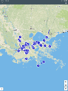
- Satellite maps have been added and can now be turned on and off.
- Detailed maps will now be automatically downloaded when a user zooms into a specific area of the map, as long as the user is connected to the internet. The user no longer needs to manually click Download detailed map but that option is still available.
- Users can choose to use the full screen of their device to view the map if they need to.
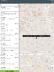
- The mobile app now supports the lookup of friendly addresses on the map:
- This is only available when online. If offline, the search bar will indicate that the user is offline.
- All maps display the new icons for address search.
- Clicking on the address search brings up a search bar
- Search results (up to 10 at a time) are listed as the user types.
- User can scroll if needed to view additional results.
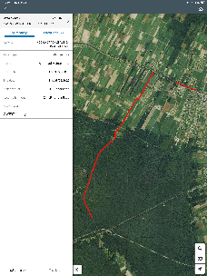
- The user can select any result from the list of search results. This adds a black dot with the location address on the map at that location.
- The map will automatically pan and zoom to the selected location.
- Clicking anywhere on the screen closes the searched location.
- Once an address is selected, the left panel closes and the address appears on the map.
- If there is no internet connection, a message will notify users of this when they click the search icon.
- If the internet connection drops while the user is searching, the message on the left panel will say that there is no internet connection.
- If the user enters the address that does not exist, an error message will notify them that "There were no results found for <entered text>"
The WM app has been reverted from the 7.4+ UI to the 7.3.6 UI with the following improvements still supported:
New sync mechanism introduced in 7.4.4.
New map control introduced in 7.4.5.
Icons and improved location rendering on the map.
Bug fixes introduced after 7.3.6 which are not related to the new UI.
Structures Inspector
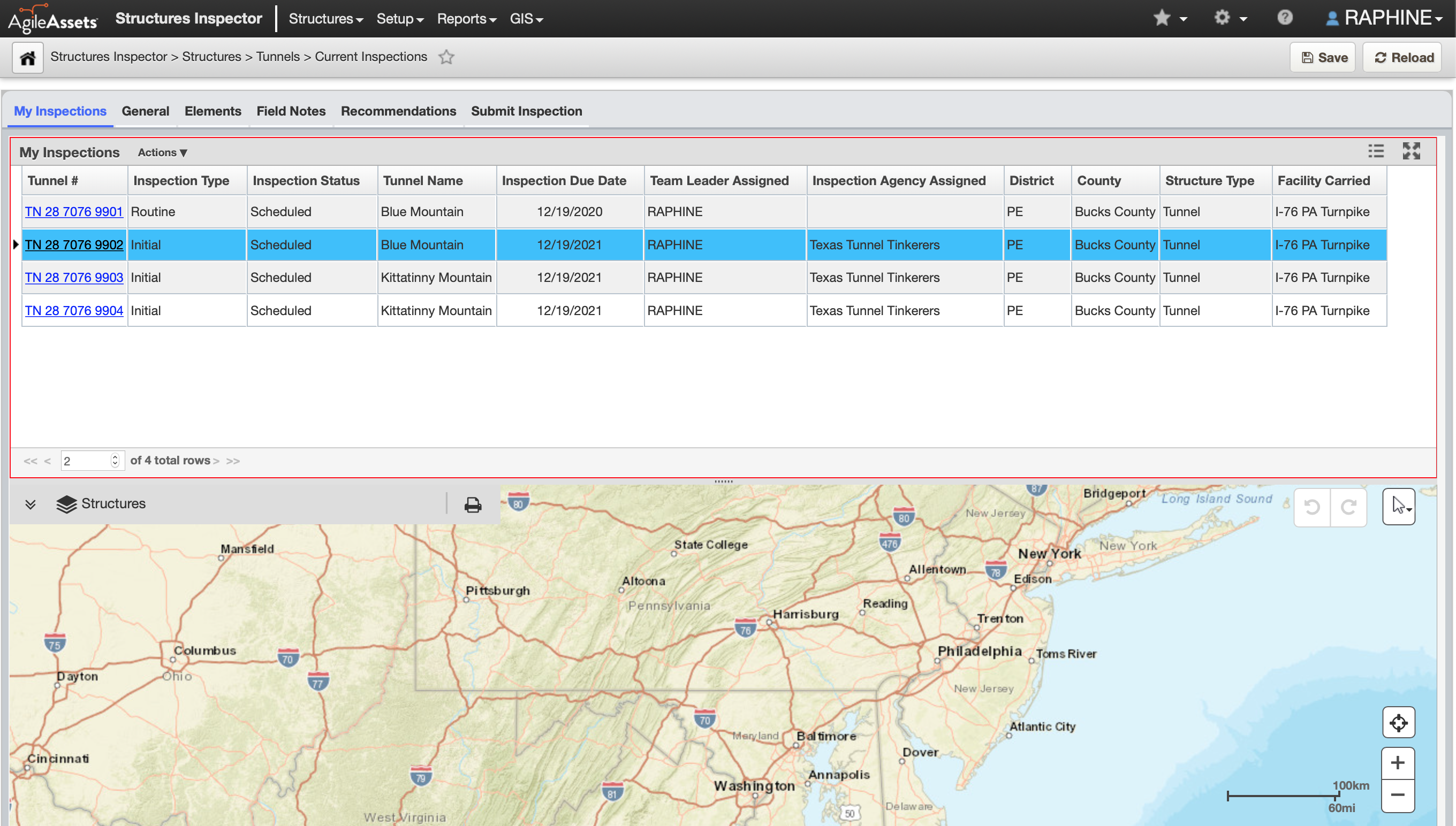
The structures inspector web application now fully supports the management and inspection of tunnels. Agencies can empower their tunnel program managers and other tunnel management personnel, to manage the inventory and inspections of their tunnels network and also be able to generate the NTI (National Tunnel Inventory) report for submission to the FHWA. The capabilities of the system include the following:
- View the tunnel inventory.
- Edit the tunnel inventory with a quality assurance phase for verification of edits.
- Plan and schedule inspections to be inspected by a third party firm or the agency's inspectors.
- Record inspections and collect element ratings, defects and attach media (photos, sketches etc) as evidence.
- Perform quality assurance of completed inspections.
- Generate an NTI submission report file for a candidate year.
Pavement Analyst
- Users can select to execute a pavement analysis scenario without including geometry (this improves execution time of the analysis) and then select to add geometry for scenario results they would like to plot on a map
- Users can now select on-demand, which management section definition that an analysis scenario should be executed against. This allows for generating scenario results for reporting on 0.1 mile sections, and generating scenario results for workplans using an agency's section segmentation.
Other Improvements and Bug Fixes
- Added: Cut and Paste have been added to the Reports shortcut menu.
- Added: It is now possible to save map layers inside a group in GIS Explorer.
- Added: Last Updated By and Last Updated Date are now available in System Foundation tables.
- Added: Weekends can now be validated for the Drop-Off Date in the Create Motorpool User Reservation window and the Motorpool Dispatch window in Fleet and Equipment Manager.
- Added: Work Order Location Comments are now possible to add to the following Reports:
- MATERIAL_TRANSACTIONS_USAGE_VW
- REPORT_FEMA
- REPORT_INFO_E_AND_DC
- REPORT_SECTION_WORK_ORDERS_GIS
- REPORT_WO_SECTIONS
- REPORT_WORK_ORDERS_ALL_COSTS
- Fixed: Issue in ESRI Roads and Highways has been resolved and some bound map features on geometry conversions now generate Java errors.
- Fixed: Issue in Facilities Manager has been resolved and attaching files in Internet Explorer no longer generates an error.
- Fixed: Issue in Fleet and Equipment Manager has been resolved and the Fixed Motorpool Dispatch window now opens correctly.
- Fixed: Issue in Fleet and Equipment Manager has been resolved and logging inventory will no longer generate an error for string concatenation length.
- Fixed: Issue in Fleet and Equipment Manager has been resolved and updates can now be saved to the Motorpool Dispatch window.
- Fixed: Issue in Fleet and Equipment Manager has been resolved and records can now be approved from the Mobile Fuel Transfer window.
- Fixed: Issue in Fleet and Equipment Manager has been resolved and the "Cannot invoke Method round () on null subject GroovyScript ID: 110320" error will no longer appear.
- Fixed: Issue in GIS Explorer has been resolved and all maps and layers display correctly in the catalog after creating a new folder.
- Fixed: Issue in GIS Explorer has been resolved and it is now possible for a visible layer within an otherwise hidden group, only that layer will become visible. If all layers are hidden, the group will become hidden.
- Fixed: Issue in GIS Explorer has been resolved and layer visibility when grouped will be determined by that group's visibility. If group visibility is turned on then the layer will be visible.
- Fixed: Issue in ITS has been resolved and the navigation buttons in the footer now function correctly when switching between Work Requests.
- Fixed: Issue in Maintenance Manager has been resolved and Work Order History window search parameters now appear correctly in the drop-down list.
- Fixed: Issue in multiple products has been resolved and temporal attachment files are now removed successfully when records are deleted or orphaned.
- Fixed: Issue in multiple products that support a right-to-left interface has been resolved and grid record indicator caret now oriented correctly.
- Fixed: Issue in Pavement Analyst has been resolved and Calculated Expression Name is now editable.
- Fixed: Issue in Pavement Analyst has been resolved and selecting and copying Work Plans no longer generates an error.
- Fixed: Issue in Pavement Analyst has been resolved and the optimization process now calculates treatment and cost for the years preceding projects in the Master Work Plan.
- Fixed: Issue in Pavement Analyst has been resolved and updating the Total Estimated Cost no longer generates an error.
- Fixed: Issue in Pavement Management has been resolved and drop-down columns for combined line and scatter graphs are now available.
- Fixed: Issue in Pavement Manager has been resolved and Construction History can now be sorted by Year Completion.
- Fixed: Issue in Pavement Manager has been resolved and the Time Delayed Import Tool (TDIT) can no longer generate duplicate records when reassigning and no longer causes issues accessing the table.
- Fixed: Issue in Reports has been resolved and Report Owner is set properly on reports that have been copied from an existing report.
- Fixed: Issue in Resources has been resolved and deleting or approving items from the Material Management window no longer generates an error.
- Fixed: Issue in Resources has been resolved and users can now approve hours from the pop-up window on the Timseheets window and those approved hours are saved and included in the Total Hours on the Employees table.
- Fixed: Issue in Roadway has been resolved and the Day Cards window now correctly indicates Edit Work Order Dates.
- Fixed: Issue in Roadway Maintenance has been resolved and bridge records from the Bridge Inspection window now correctly populate on the bottom pane.
- Fixed: Issue in Roadway Maintenance has been resolved and inventory items from the map now appear in the left pane as well.
- Fixed: Issue in Roadway Maintenance has been resolved and new records can be inserted and saved in the Bridge tab whether there are existing records or not.
- Fixed: Issue in Roadway Maintenance has been resolved and the Insert Like function is working now and the Route field is correctly populating.
- Fixed: Issue in Roadway Maintenance has been resolved and the NullPointer exception is no longer conflicting with editing location coordinates.
- Fixed: Issue in Roadway Maintenance has been resolved and Work Order History window no includes Work Location.
- Fixed: Issue in Signs Manager has been resolved and auditable columns on Panel Inventory and Sign System Position windows now appear correctly. Some columns are blank if there is no data to show.
- Fixed: Issue in System has been resolved and Create Asset View now functions correctly.
- Fixed: Issue in Utilities has been resolved and attaching oversized files now generates a clear error message.
Known Issues, Limitations, and Restrictions
Updates
- Structure Inspector inspections for Tunnels can currently be edited after being submitted.
- For windows devices, text boxes in the Structures Inspector mobile app, such as the General Notes field in the general inspection form or the Comments field in access needs form, display the input cursor in the middle of the text box, instead of at the top of the text box.
The Structures Inspector mobile app may crash when more than 10 photos are selected from the device album to be attached to an inspection record
Work Manager App users on Android devices with memory of less than 2GB may receive an Out of Memory Exception. Please close and reopen the app daily to avoid this issue.
When a user adds multiple photos to an inspections from a device with a full camera roll on an Android device the Structures Inspector mobile app may crash.
The Structures Inspector mobile app lists inspections in QC and QA for download but if those inspections are edited, the sync process will halt and users must click Delete on device and continue to sync their other inspections.
When downloading for the first time, please check the status of inspections and do not download inspections with a QC or QA status. To review the status of inspections that have already been downloaded, click
 and select Download Inspections.
The Structures Inspector mobile app Condition State comment text box covers the tittle.
The Structures Inspector mobile app lists the date updated as the date it was last modified from the web application even if it has been modified more recently in the mobile app.
The supplied CORS filter for Tomcat will not work on Tomcat version 8.5.32 and above. Customers need to review the use of the CORS filter and update web.xml as needed. Additional information can be found at https://tomcat.apache.org/tomcat-8.5-doc/config/filter.html
The discovery date is absent on the flag screen in Structures Inspector. Currently, the default date is the current date for flags created in the web app.
The Structures Inspector mobile app screen shifts when closing a pop-up window.
Flags can now be created in the Structures Inspector mobile app but must still be submitted to QC using the web application. Additionally, Flags Superseding and Discovery Date are not yet available in the app.
Flags cannot be set to supersede each other in the Structures Inspector mobile app.
As of Chrome 71, browser pop-ups may be blocked which will negatively affect system operations. To address this in Chrome go to Settings > Advanced > Content Settings > Pop ups and redirects and then add the URL for the application.
The new GIS Explorer like all web mapping applications requires datasets in the geographic coordinate system (EPSG:4326), so customer schemas with data stored in a different coordinate system would need to be transformed in order for map layers to be created from the dataset. See the section on re-projecting geometries in the Implementation Guide
Inserting a location or inventory item from a map is not functional when using Firefox as your web browser. To work around this limitation, use the other supported web browsers: IE 11, Chrome or Safari
When you select to print a map as an image (png file) using Firefox as your web browser, the file is downloaded as map.png.pdf. You would have to manually edit out the '.pdf' extension from the file name, after the file has been downloaded, to be able to open/use the file
When you define a map print template of size 34x44 or larger, an error is returned since the size of the generated map image always times before a PDF for printing is generated
While working on the GIS Interface and performing tasks that does not generate a request to the server (such as styling a map), your user session may expire as a result. The configured session expiration warnings will be displayed when this occurs or your session may timeout and a session expiration notification displayed, if a warning is not configured
Map filter value does not get pre-populated in the Jasper report print template, even though the parameter is specified for display in the template
Map filter value cannot be defined or edited for a map with a specified area of interest. To work around the definition limitation, the map filter should be defined before the AOI is set
A map's layer style settings become null and un-editable, when an applied filter is partially applicable or not applicable to the defined styling attribute values for the map
On a map bound to a data window, some items when selected on the map aren't highlighted in the data window because they aren't present there (In a data window, items can be Access Regulated), but on the map all inventory items are displayed
The loading and display of maps and associated styles in IE 11 is not as performant as Chrome, Firefox and Safari
In the Roads & Highways interface, routes with curves are not handled properly by the ESRI FDGB API. A workaround is to have the agency densify the routes to turn the curves into line strings
The HTML5 based copy/paste functionality has limitations on the number of rows that can be copied to a browser's clipboard
IE 11 - 4000 rows
Edge - 4000 rows
Chrome - 400 rows
Firefox - 1000 rows
IE or Edge on a Surface Tablet - 15 rows
When you select to copy rows from a data window, data from hidden columns on the window are also copied to the clipboard
The spinner indicating that a layer is loading in the GIS Explorer, continues to spin after selecting to remove a previous loading layer by using either the new map or remove layer option
When zoomed in at the 0.6km/0.4m level before selecting to print a map, the basemap is not rendered on the resulting printed map
Hebrew and other languages with special characters are not rendered properly on the properties panel of GIS Explorer
GIS Explorer does not display the contents of the screen for a right to left language setting
The owner of a GIS catalog folder no longer has access to the catalog, when the folder is shared by a GIS admin with administrative units that the owner of the folder does not belong to
A map built from an image service is not rendered in the printed document (PDF or PNG) when select to print the map
An image layer is not displayed on the map when change the basemap from the 'None' option to any other basemap option
A map comprised of layers from multiple sources including an image service, does not display the layers in the correct z-order when the layers are re-ordered
For some monitor resolutions, opening the messages dialog while the GIS Explorer window is open results in the messages dialog to be partially hidden
In FDC, when enter an incorrect password twice and then enter the correct password afterwards, a message indicating an incorrect reCAPTCHA answer is displayed
When the same editable layer is added to GIS Explorer so there are more than one active, the features on the layer cannot be dragged for an edit
The undo/redo of edits retains the actions performed even the associated layer has been removed
When add a new editable layer to a map with in-progress edits, the undo and redo options are temporarily disabled. Performing an edit re-enables undo/redo and previous edits can be undone or redone
When a user a user enters an incorrect username or password in the Work Manager mobile app, an incorrect message 'Unable to connect to server' is displayed
In Microsoft Edge, some admin units in the Admin Units drop-down on the inspection team's creation dialog, appear as actionable links
Setting some columns as fixed in a data window is not functional in IE 11
Setting of columns as fixed in a data window is not supported in right to left language displays, such as for Hebrew or Arabic, i.e. only the left most columns can be fixed
GIS Explorer does not display a basemap nor the basemap selection dialog, when using Microsoft Edge web browser. However, basemaps function as expected with IE 11, Chrome and Firefox web browsers
There is an issue in ESRI ArcGIS Enterprise 10.6.1, that prevents the publishing of services for Oracle tables or views with a geometry column owner of MDSYS. When the ESRI issue is addressed, we will test and ensure that the functionality has been restored